Rickford pump
Introduction
The photograph on this page of Rickford pump by Neil Owen as part of the Geograph project.
The Geograph project started in 2005 with the aim of publishing, organising and preserving representative images for every square kilometre of Great Britain, Ireland and the Isle of Man.

There are currently over 7.5m images from over 14,400 individuals and you can help contribute to the project by visiting https://www.geograph.org.uk
Rickford pump
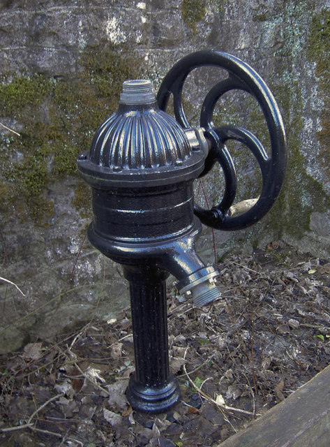
Image: © Neil Owen Taken: 16 Feb 2016
The village used to take its water from this standpipe; it appears to be a modern version but there seems to have been a pipe here from the late nineteenth century. Even though the village has a number of Bristol Waterworks buildings and plant right on their doorsteps, the villagers were often to be found taking water directly from the brook here, right up until the 1940s.
Images are licensed for reuse under creativecommons.org/licenses/by-sa/2.0
Image Location
Latitude
51.330465
Longitude
-2.738415