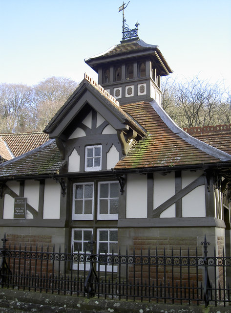
Gauge House
Introduction
The photograph on this page of Gauge House by Neil Owen as part of the Geograph project.
The Geograph project started in 2005 with the aim of publishing, organising and preserving representative images for every square kilometre of Great Britain, Ireland and the Isle of Man.
There are currently over 7.5m images from over 14,400 individuals and you can help contribute to the project by visiting https://www.geograph.org.uk

Image: © Neil Owen Taken: 16 Feb 2016
This interesting little building is part of Bristol Waterworks. It rests over the Rickford Spring and acts as a regulating weir to control the water flowing down the valley and extracted by pipeline to the Blagdon works. From there the water goes into the supply system for Bristol. The house was built in 1895 and has been described thus: "Late C19. Wooden raft supported by cast iron stanchions over brook. House of rockfaced coursed red sandstone with green sandstone dressings on a limestone plinth. Timber frame outer skin on brick with roughcast infill and plain tile roof. Swiss chalet style. Square on plan with a pyramidal roof and open apex turret with weathervane. Window and door openings to each face which develop into gabled dormers; plank doors with fine ironwork hinges. Retaining wall to roadside of rockfaced squared sandstone with ashlar coping and piers and wrought iron railings." It is perhaps more notable for having an unusual architectural style for such a functional utility. Just up the lane is the former church, which is much the same style. As the latter was built as part of the Wills tobacco estate, it is likely they were of similar origin.

