Taplow and Wendover Houses, Thurlow Street
Introduction
The photograph on this page of Taplow and Wendover Houses, Thurlow Street by Stephen Richards as part of the Geograph project.
The Geograph project started in 2005 with the aim of publishing, organising and preserving representative images for every square kilometre of Great Britain, Ireland and the Isle of Man.

There are currently over 7.5m images from over 14,400 individuals and you can help contribute to the project by visiting https://www.geograph.org.uk
Taplow and Wendover Houses, Thurlow Street
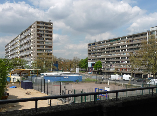
Image: © Stephen Richards Taken: 6 May 2013
Two of the estate's mammoth 'barrier blocks' as seen from one of its elevated walkways. Built by Southwark Council in 1967-77 by the Borough Architect F.O. Hayes and his successor H.P. Trenton. One of the largest public housing estates in Europe, its 64 acres house around 8,000 people in almost 2,500 dwellings. It's easy to forget the sub-standard housing it replaced, but the sheer scale of the estate is daunting. Southwark Council has now decided to pull it down - in a strange twist in the early C21st it is carrying out social cleansing on a scale like no other (e.g. see also Image]).
Images are licensed for reuse under creativecommons.org/licenses/by-sa/2.0
Image Location
Latitude
51.488203
Longitude
-0.08622