Former Herne Bay Methodist Church, High Street
Introduction
The photograph on this page of Former Herne Bay Methodist Church, High Street by John Baker as part of the Geograph project.
The Geograph project started in 2005 with the aim of publishing, organising and preserving representative images for every square kilometre of Great Britain, Ireland and the Isle of Man.

There are currently over 7.5m images from over 14,400 individuals and you can help contribute to the project by visiting https://www.geograph.org.uk
Former Herne Bay Methodist Church, High Street
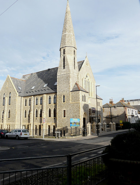
Image: © John Baker Taken: 25 Jan 2016
Planning permission has been granted by Canterbury City Council under application number CA//15/00375 for a “request for a non-material amendment in respect of CA//09/00999/FUL for the conversion of former church to Community Hall with nine apartments; revisions in respect of omission of dormer windows and replacement by rooflights”. Wilbee and Son, estate agents & letting agents Kent http://www.wilbeeandson.co.uk/ have erected a for sale board for luxury apartments outside the building.
Images are licensed for reuse under creativecommons.org/licenses/by-sa/2.0
Image Location
Latitude
51.371373
Longitude
1.126522