Destroyed boardwalk near Belgrave Lock no 44
Introduction
The photograph on this page of Destroyed boardwalk near Belgrave Lock no 44 by Mat Fascione as part of the Geograph project.
The Geograph project started in 2005 with the aim of publishing, organising and preserving representative images for every square kilometre of Great Britain, Ireland and the Isle of Man.

There are currently over 7.5m images from over 14,400 individuals and you can help contribute to the project by visiting https://www.geograph.org.uk
Destroyed boardwalk near Belgrave Lock no 44
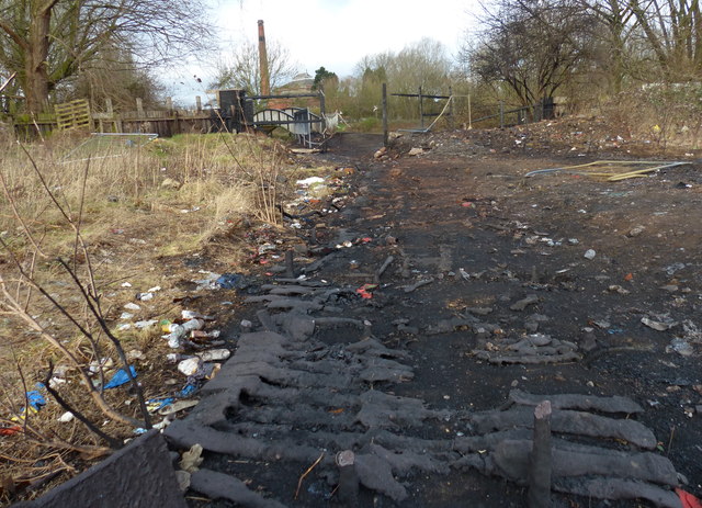
Image: © Mat Fascione Taken: 7 Feb 2016
This boardwalk used to run between Ross Walk and the Swans Nest Footbridge across the Grand Union Canal, it was recently destroyed in a fire.
Images are licensed for reuse under creativecommons.org/licenses/by-sa/2.0
Image Location
Latitude
52.653471
Longitude
-1.128236