Final yards of the River Mole
Introduction
The photograph on this page of Final yards of the River Mole by Christopher Hilton as part of the Geograph project.
The Geograph project started in 2005 with the aim of publishing, organising and preserving representative images for every square kilometre of Great Britain, Ireland and the Isle of Man.

There are currently over 7.5m images from over 14,400 individuals and you can help contribute to the project by visiting https://www.geograph.org.uk
Final yards of the River Mole
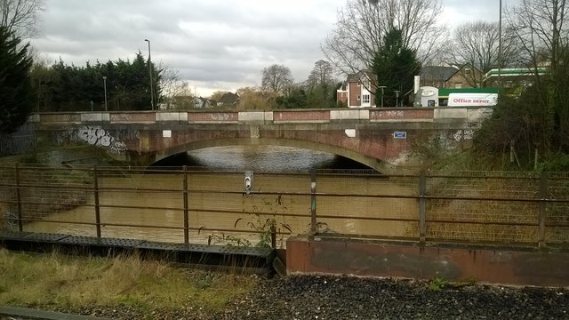
Image: © Christopher Hilton Taken: 10 Feb 2016
Swollen with rains, the Mole here flows towards the camera and under the platforms of Hampton Court station, on its way to the Thames. A little way above the road bridge lies the confluence of the Mole and its alternative channel the Ember.
Images are licensed for reuse under creativecommons.org/licenses/by-sa/2.0
Image Location
Latitude
51.40102
Longitude
-0.343033