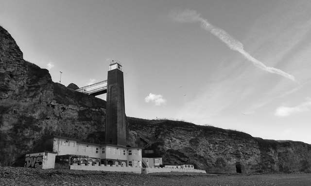
Marsden Grotto
Introduction
The photograph on this page of Marsden Grotto by Mick Garratt as part of the Geograph project.
The Geograph project started in 2005 with the aim of publishing, organising and preserving representative images for every square kilometre of Great Britain, Ireland and the Isle of Man.
There are currently over 7.5m images from over 14,400 individuals and you can help contribute to the project by visiting https://www.geograph.org.uk

Image: © Mick Garratt Taken: 10 Feb 2016
The Marsden Grotto is a pub cum restaurant built into a sea cave on the beach at South Shields. It’s accessible by a lift from the cliff top above. Jack and Jessie Bates are supposed to have first inhabited the cave in 1782. Jack used explosives from the nearby quarry to make the cave bigger earning him his nickname "Jack the Blaster”. Access then was by steps cut into the cliff. The couple started to sell refreshments to visitors and locals allegedly involved in smuggling contraband. In 1826 Peter Allen brought the Marsden Grotto off the Bates family and formally expanded it into an inn with 15 rooms including a ballroom. In 1848 the land on the cliff top known as The Leas was brought by John Clay who claimed this gave him the rights to the Grotto. A court battle ensued which Allen lost. He died a year later from depression. His family continued to run the Grotto for another 35 years on payment of rent to Clay. In the course of development of the colliery at Whitburn the Grotto came into the ownership of the Harton Coal Company during which it fell into disrepair. Fortunately Vaux Breweries took over the management in 1898 eventually purchasing it in 1938. The buildings were refurbished and the lift added to the top of the cliff. In 1999 the Grotto closed its doors. Vaux unsuccessfully tried to sell it. Eventually a buyer was found. More refurbishment and several changes of ownership followed. In 2007 the steps down to the beach were condemned forcing closure of the Grotto as there was no other means of exit in an emergency should the lift fail. Today the place looks neglected but contractors are in so the prospects look hopeful.

