
Roman fort at The Lunt, Baginton
Introduction
The photograph on this page of Roman fort at The Lunt, Baginton by E Gammie as part of the Geograph project.
The Geograph project started in 2005 with the aim of publishing, organising and preserving representative images for every square kilometre of Great Britain, Ireland and the Isle of Man.

There are currently over 7.5m images from over 14,400 individuals and you can help contribute to the project by visiting https://www.geograph.org.uk
Roman fort at The Lunt, Baginton
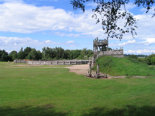
Image: © E Gammie Taken: 29 Jun 2007
Looking towards the reconstructions of the wooden gyrus and ramparts. The earthworks and buried remains are scheduled as a national monument (no. 30057). Initial construction of the fort is estimated to have been AD60-64 and three main phases of development have been identified by archaeologists. The earliest fort was defended by a bank and ditch to the north and west with evidence for defences found to the south and east. Remains of timber buildings for barracks, store houses and officers quarters on raised wooden floors have been found, together with evidence of rubbish and latrine pits, wells, bread ovens in the ramparts and various pottery, coin and metalware finds. The fort was later built on a different alignment and a circular 30m diameter enclosure added, which is believed to be the gyrus (horse schooling ring). This, and other evidence of stables and horse fittings lead archaeologists to the belief that the fort may have had a large cavalry contingent. In the 3rd phase, the southern boundary was moved north, reducing the fort area.
Images are licensed for reuse under creativecommons.org/licenses/by-sa/2.0
Image Location

Latitude
52.373141
Longitude
-1.496431