Ratcliffe Gate, Mansfield, Notts.
Introduction
The photograph on this page of Ratcliffe Gate, Mansfield, Notts. by David Hallam-Jones as part of the Geograph project.
The Geograph project started in 2005 with the aim of publishing, organising and preserving representative images for every square kilometre of Great Britain, Ireland and the Isle of Man.

There are currently over 7.5m images from over 14,400 individuals and you can help contribute to the project by visiting https://www.geograph.org.uk
Ratcliffe Gate, Mansfield, Notts.
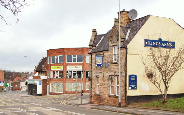
Image: © David Hallam-Jones Taken: 7 Feb 2016
The Kings Arms public house is seen dominating this corner site at its junction with Newgate Street. The town centre lies ahead. After a spell in Newgate Lane, in 1914 Mansfield Town Football Club moved to a large grassed area south of Ratcliffe Gate, that gloried in the name of "The Prairie" due to this being a wide open space.
Images are licensed for reuse under creativecommons.org/licenses/by-sa/2.0
Image Location
Latitude
53.142664
Longitude
-1.18893