Former "Parkview Bar", Belfast (February 2016)
Introduction
The photograph on this page of Former "Parkview Bar", Belfast (February 2016) by Albert Bridge as part of the Geograph project.
The Geograph project started in 2005 with the aim of publishing, organising and preserving representative images for every square kilometre of Great Britain, Ireland and the Isle of Man.

There are currently over 7.5m images from over 14,400 individuals and you can help contribute to the project by visiting https://www.geograph.org.uk
Former "Parkview Bar", Belfast (February 2016)
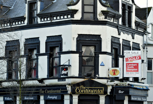
Image: © Albert Bridge Taken: 7 Feb 2016
See Image Now with a “sold” patch on the agents’ sign facing the Ravenhill Road. The old name “Parkview Bar” is still visible on the awning below the “for sale” sign. The truncated remains of Taylor’s Row are out of picture to the left.
Images are licensed for reuse under creativecommons.org/licenses/by-sa/2.0
Image Location
Latitude
54.59132
Longitude
-5.910263