The pump-house at Trow
Introduction
The photograph on this page of The pump-house at Trow by David Smith as part of the Geograph project.
The Geograph project started in 2005 with the aim of publishing, organising and preserving representative images for every square kilometre of Great Britain, Ireland and the Isle of Man.

There are currently over 7.5m images from over 14,400 individuals and you can help contribute to the project by visiting https://www.geograph.org.uk
The pump-house at Trow
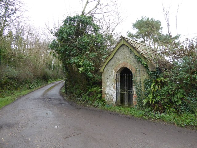
Image: © David Smith Taken: 4 Feb 2016
The building is secured by an iron gate. Inside is the pump used to supply water to Trow, and a board detailing the history of the use of the building. The well was sunk in 1881, in memory of Anderson Morshead, a local clergyman. The well was deepened in 1900 and again in 1909 (after the well had run dry). It was in use until piped water was supplied to Trow in 1915. The building and pump are cared for by the Sid Vale Association
Images are licensed for reuse under creativecommons.org/licenses/by-sa/2.0
Image Location
Latitude
50.697798
Longitude
-3.199232