
All Saints Church, Church Lane, Frostenden
Introduction
The photograph on this page of All Saints Church, Church Lane, Frostenden by Jo and Steve Turner as part of the Geograph project.
The Geograph project started in 2005 with the aim of publishing, organising and preserving representative images for every square kilometre of Great Britain, Ireland and the Isle of Man.

There are currently over 7.5m images from over 14,400 individuals and you can help contribute to the project by visiting https://www.geograph.org.uk
All Saints Church, Church Lane, Frostenden
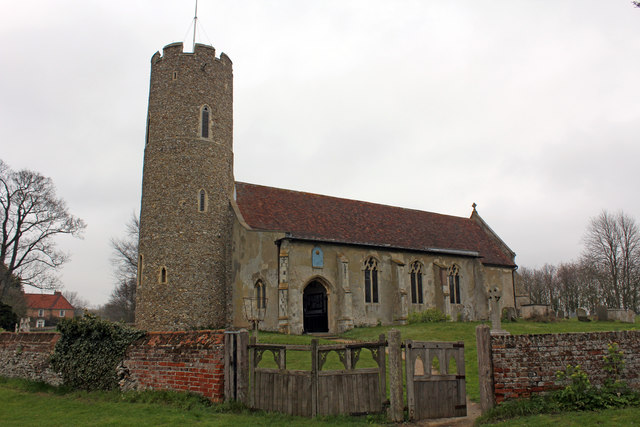
Image: © Jo and Steve Turner Taken: 8 Apr 2012
Grade I Listed medieval church restored about 1890 according to the listing. A photograph by Henry Munro Cautley FSA ARIBA labelled 'Restored and re-opened 9th April 1936' shows the church with no roof and roof trusses partially replaced. The tower is either Norman or even Saxon and one of Suffolk's oldest round towers. All Saints was built in the 13th century and the main body of the church consists of nave, chancel, and 15th century south aisle. The nave door and lean-to aisle roof are largely original. The parish registers date from 1538. The Domesday Book of 1086 shows that sea-going ships tied up here, indicating that the now dried-up river bed behind the church was once navigable. There were also two churches here.
Images are licensed for reuse under creativecommons.org/licenses/by-sa/2.0
Image Location

Latitude
52.377541
Longitude
1.641143