
Slaterfield Fell & Kirkshield at road end
Introduction
The photograph on this page of Slaterfield Fell & Kirkshield at road end by Andrew Curtis as part of the Geograph project.
The Geograph project started in 2005 with the aim of publishing, organising and preserving representative images for every square kilometre of Great Britain, Ireland and the Isle of Man.

There are currently over 7.5m images from over 14,400 individuals and you can help contribute to the project by visiting https://www.geograph.org.uk
Slaterfield Fell & Kirkshield at road end
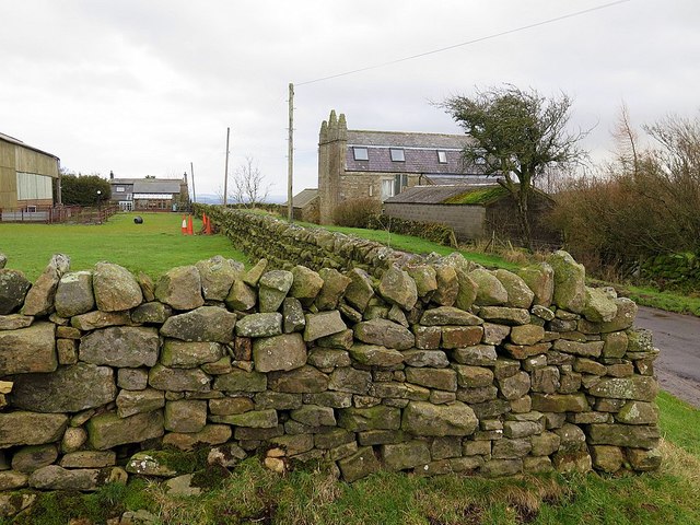
Image: © Andrew Curtis Taken: 5 Feb 2016
"Outside the south wall of the churchyard [Simonburn] a farm road leads up westward to the fell top. After passing three lonely farms it comes to the quaint house named Kirkshield with its crocketed pinnacles, built as a shooting lodge by a seventeenth century rector. Just past the house the road comes to an end, being crossed by an ancient drove-road. This comes down from the north, its wide grass-track leading southwards towards the Roman Wall and beyond. One wonders how often it has seen stolen lowland cattle being driven northwards in the old days of the moss-troopers." The Great Parish of Simonburn from Hadrian's Wall to Carter Bar: An Historical Guide by Cecil Dickson Ward Davis (1972).
Images are licensed for reuse under creativecommons.org/licenses/by-sa/2.0
Image Location

Latitude
55.049111
Longitude
-2.23474