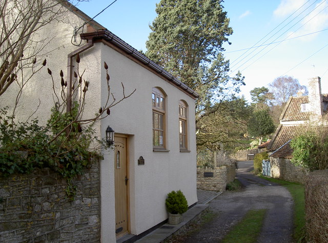
The old chapel in Mill Lane
Introduction
The photograph on this page of The old chapel in Mill Lane by Neil Owen as part of the Geograph project.
The Geograph project started in 2005 with the aim of publishing, organising and preserving representative images for every square kilometre of Great Britain, Ireland and the Isle of Man.
There are currently over 7.5m images from over 14,400 individuals and you can help contribute to the project by visiting https://www.geograph.org.uk

Image: © Neil Owen Taken: 2 Feb 2016
This modest building along the banks of the River Chew has an interesting history. Originally believed to be a farm building, it was appointed as a Baptist chapel in the nineteenth century. It also appears to have served as a farmworkers' refuge before changing in the 1970s. Then it was a store and a catering concern, which caused a certain amount of village disdain over parking. Eventually it closed and was left unoccupied. Now it appears that the extensive renovation carried out will not allow it to become a commercial property, although it is offered as a private residence.

