Hide Hill
Introduction
The photograph on this page of Hide Hill by Ian Capper as part of the Geograph project.
The Geograph project started in 2005 with the aim of publishing, organising and preserving representative images for every square kilometre of Great Britain, Ireland and the Isle of Man.

There are currently over 7.5m images from over 14,400 individuals and you can help contribute to the project by visiting https://www.geograph.org.uk
Hide Hill
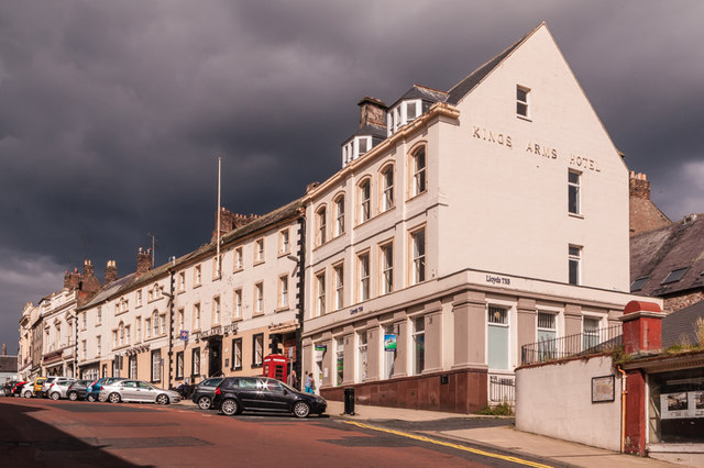
Image: © Ian Capper Taken: 15 Aug 2011
The east side of Hide Hill, made up largely of the Kings Arms Hotel, the main section (beyond the first building housing what at the time of this photo was Lloyds TSB Bank) of which is Georgian and grade II listed - see http://www.historicengland.org.uk/listing/the-list/list-entry/1290070.
Images are licensed for reuse under creativecommons.org/licenses/by-sa/2.0
Image Location
Latitude
55.768325
Longitude
-2.002588