Teifi Marsh
Introduction
The photograph on this page of Teifi Marsh by Deborah Tilley as part of the Geograph project.
The Geograph project started in 2005 with the aim of publishing, organising and preserving representative images for every square kilometre of Great Britain, Ireland and the Isle of Man.

There are currently over 7.5m images from over 14,400 individuals and you can help contribute to the project by visiting https://www.geograph.org.uk
Teifi Marsh
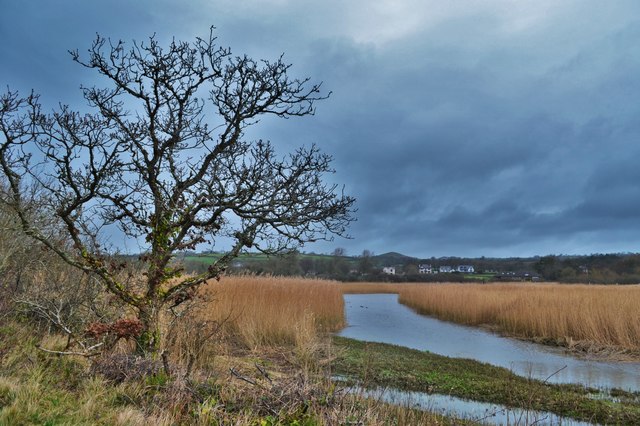
Image: © Deborah Tilley Taken: 31 Jan 2016
Banc-y-Warren Crugmore, high point, in the distance. This rather strange conical hill had a defended enclosure built on it in the Iron Age. The battle of Crug Mawr was fought in the vicinity in 1136 (Welsh 1, Normans 0). It seems to be the location for the following story: Crug Mawr, or Pen tychryd Mawr, is a mountain, or lofty hill, in Cardiganshire, situated in the vale of Ayeron, mentioned in Giraldus, where, he says, "there is an open grave, which fits the length of any man lying in it, short or long." Hence rose the ancient tradition, that a powerful cawr, or giant, kept his post on this hill, who was endowed with the genius of the Ayeron vale. He had a lofty palace erected on the hill, and used occasionally to invite the neighbouring giants to a trial of strength on the top of it; at one of these meetings coits were proposed and introduced, and, after great efforts, the inhabitant of the spot won the day, by throwing his quoit clear into the Irish shore, which ever after gave him the superiority over all other giants in Caredig land. He then proceeds to explain the stories away in a manner that completely misses the point that they are stories, invoking mistranslations and concealed machinery. Tch. From 'The Cambrian Popular Antiquities' by Peter Roberts, 1815. http://www.archive.org/stream/cambrianpopular00robegoog#page/n238/
Images are licensed for reuse under creativecommons.org/licenses/by-sa/2.0
Image Location


Leaflet Map data © OpenStreetMap
Latitude
52.079688
Longitude
-4.644258