Camp Street
Introduction
The photograph on this page of Camp Street by Gerald England as part of the Geograph project.
The Geograph project started in 2005 with the aim of publishing, organising and preserving representative images for every square kilometre of Great Britain, Ireland and the Isle of Man.

There are currently over 7.5m images from over 14,400 individuals and you can help contribute to the project by visiting https://www.geograph.org.uk
Camp Street
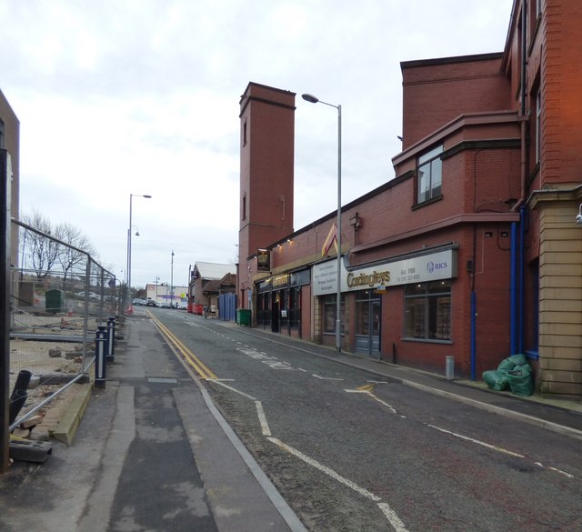
Image: © Gerald England Taken: 23 Jan 2016
On the left is new building for Tameside College. On the right is the Old Fire Station now converted into an office for Cordingley's estate agents, Bromley solicitors and a public house, The Engine Room Image
Images are licensed for reuse under creativecommons.org/licenses/by-sa/2.0
Image Location


Leaflet Map data © OpenStreetMap
Latitude
53.490284
Longitude
-2.092803