Holy Loch
Introduction
The photograph on this page of Holy Loch by Richard Webb as part of the Geograph project.
The Geograph project started in 2005 with the aim of publishing, organising and preserving representative images for every square kilometre of Great Britain, Ireland and the Isle of Man.

There are currently over 7.5m images from over 14,400 individuals and you can help contribute to the project by visiting https://www.geograph.org.uk
Holy Loch
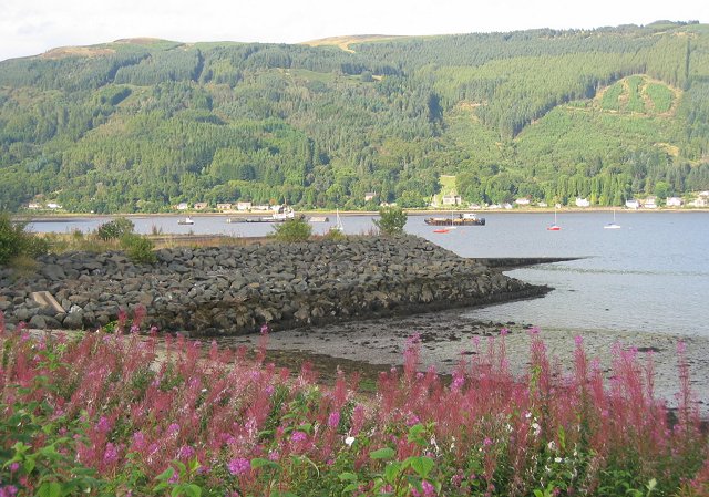
Image: © Richard Webb Taken: 2 Sep 2005
Embankment on the outskirts of Sandbank. Still trying to work out where the USN submarine base was. Hard to believe that this loch was a front line in the Cold War. That has since moved to neighbouring lochs to await the next one. The local economy suffered hard when Yankee went home.
Images are licensed for reuse under creativecommons.org/licenses/by-sa/2.0
Image Location


Leaflet Map data © OpenStreetMap
Latitude
55.984751
Longitude
-4.952661