
Descending New Haw Lock, Wey Navigation
Introduction
The photograph on this page of Descending New Haw Lock, Wey Navigation by Dr Neil Clifton as part of the Geograph project.
The Geograph project started in 2005 with the aim of publishing, organising and preserving representative images for every square kilometre of Great Britain, Ireland and the Isle of Man.

There are currently over 7.5m images from over 14,400 individuals and you can help contribute to the project by visiting https://www.geograph.org.uk
Descending New Haw Lock, Wey Navigation
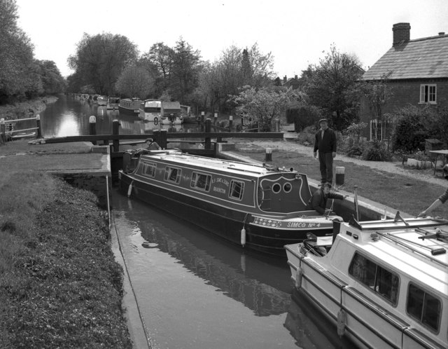
Image: © Dr Neil Clifton Taken: 12 May 1974
Two boats share New Haw Lock as they descend towards the Thames. Whether the authoritative-looking figure on the bank is the lock keeper, I do not know.
Images are licensed for reuse under creativecommons.org/licenses/by-sa/2.0
Image Location

Latitude
51.356552
Longitude
-0.48582