Warsop Mill Vicinity, Church Warsop, Notts.
Introduction
The photograph on this page of Warsop Mill Vicinity, Church Warsop, Notts. by David Hallam-Jones as part of the Geograph project.
The Geograph project started in 2005 with the aim of publishing, organising and preserving representative images for every square kilometre of Great Britain, Ireland and the Isle of Man.

There are currently over 7.5m images from over 14,400 individuals and you can help contribute to the project by visiting https://www.geograph.org.uk
Warsop Mill Vicinity, Church Warsop, Notts.
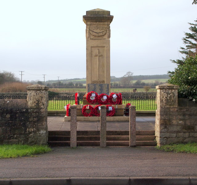
Image: © David Hallam-Jones Taken: 23 Jan 2016
The Grade II-listed, limestone ashlar and granite war memorial, c.1920, is seen from the side of Church Street, i.e. the A60. It sits in the corner of a car park set aside for visitors to The Carrs Nature Reserve. Warsop Mill is situated behind the photographer, on the opposite side of the A60.
Images are licensed for reuse under creativecommons.org/licenses/by-sa/2.0
Image Location
Latitude
53.212153
Longitude
-1.150632