Parish Hall, Church Warsop, Notts.
Introduction
The photograph on this page of Parish Hall, Church Warsop, Notts. by David Hallam-Jones as part of the Geograph project.
The Geograph project started in 2005 with the aim of publishing, organising and preserving representative images for every square kilometre of Great Britain, Ireland and the Isle of Man.

There are currently over 7.5m images from over 14,400 individuals and you can help contribute to the project by visiting https://www.geograph.org.uk
Parish Hall, Church Warsop, Notts.
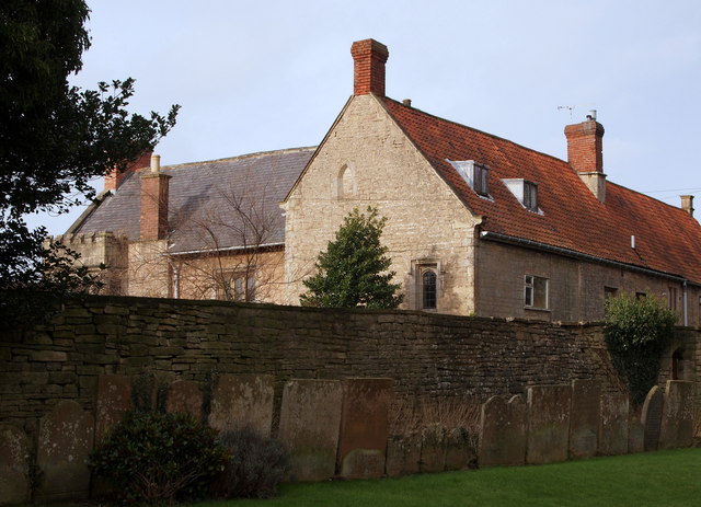
Image: © David Hallam-Jones Taken: 23 Jan 2016
C18th gravestones in the shadow of the boundary wall separating the west side of the church and the eastern elevation of the parish hall. It could be the case that the building on the other side of the wall has been "sold off" and converted into a private house, whilst the church authorities retained the barn on Bishop's Lane for use as their parish hall?
Images are licensed for reuse under creativecommons.org/licenses/by-sa/2.0
Image Location
Latitude
53.213239
Longitude
-1.151659