Parish Church Vicinity, Church Warsop, Notts.
Introduction
The photograph on this page of Parish Church Vicinity, Church Warsop, Notts. by David Hallam-Jones as part of the Geograph project.
The Geograph project started in 2005 with the aim of publishing, organising and preserving representative images for every square kilometre of Great Britain, Ireland and the Isle of Man.

There are currently over 7.5m images from over 14,400 individuals and you can help contribute to the project by visiting https://www.geograph.org.uk
Parish Church Vicinity, Church Warsop, Notts.
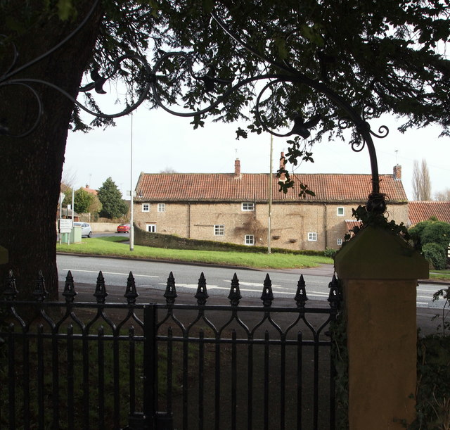
Image: © David Hallam-Jones Taken: 23 Jan 2016
On the south side of the church, and at a lower level, a path exits onto the pavement at the side of Church Road (the A60). Users are obliged to pass through this Grade II-listed gateway with panelled ashlar piers with hipped ashlar caps. The iron spearhead gates are seen here, as is the scrolled foliate wrought-iron arch (a.k.a. overthrow). A red car can be seen on Eastlands Lane passing the side of some cottages.
Images are licensed for reuse under creativecommons.org/licenses/by-sa/2.0
Image Location
Latitude
53.212423
Longitude
-1.150627