
Ordnance Survey Benchmark and Bolt - Stanground, St. John the Baptist's Church
Introduction
The photograph on this page of Ordnance Survey Benchmark and Bolt - Stanground, St. John the Baptist's Church by N Scott as part of the Geograph project.
The Geograph project started in 2005 with the aim of publishing, organising and preserving representative images for every square kilometre of Great Britain, Ireland and the Isle of Man.

There are currently over 7.5m images from over 14,400 individuals and you can help contribute to the project by visiting https://www.geograph.org.uk
Ordnance Survey Benchmark and Bolt - Stanground, St. John the Baptist's Church
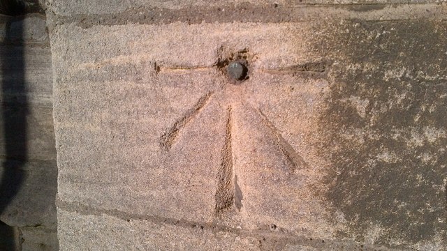
Image: © N Scott Taken: 15 Jan 2016
Ordnance Survey Benchmark (OSBM) used for levelling height above Ordnance Datum (OD). Height: 10.6802m OD (Newlyn). Mark verified by the Ordnance Survey in 1962. Description: ST JOHN THE BAPTISTS CH S FACE SPIRE SE ANG. 1.2m above ground. 3rd Order BM. The bolt was included as a branch level from mark 138 on the Towcester to King's Lynn line of the First Primary Levelling of England & Wales in 1852. It was levelled with a height of 35.928’ above OD (Liverpool). Description: Standground Church. Bolt in South side of spire ; 3.81 ft. above surface. Page 314 of the abstract: http://www.trigtools.co.uk/data/1GL/1GLA_314.png Context: Image
Images are licensed for reuse under creativecommons.org/licenses/by-sa/2.0
Image Location

Latitude
52.561844
Longitude
-0.231475