
A1033 Burstwick Drain Flyover Bridge
Introduction
The photograph on this page of A1033 Burstwick Drain Flyover Bridge by Andy Beecroft as part of the Geograph project.
The Geograph project started in 2005 with the aim of publishing, organising and preserving representative images for every square kilometre of Great Britain, Ireland and the Isle of Man.

There are currently over 7.5m images from over 14,400 individuals and you can help contribute to the project by visiting https://www.geograph.org.uk
A1033 Burstwick Drain Flyover Bridge
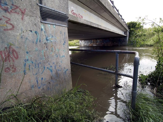
Image: © Andy Beecroft Taken: 28 Jun 2007
As seen here, the bridge was a victim of the June 2007 floods. The fence in the foreground and also the other at the other side normally provide pedestrians with some security when using the twin paths at either side of the drain. Both paths on this occasion are some 30cm below the drain water level and are of no use whatsoever!
Images are licensed for reuse under creativecommons.org/licenses/by-sa/2.0
Image Location

Latitude
53.735902
Longitude
-0.209702