New development, John Street, Renton
Introduction
The photograph on this page of New development, John Street, Renton by Lairich Rig as part of the Geograph project.
The Geograph project started in 2005 with the aim of publishing, organising and preserving representative images for every square kilometre of Great Britain, Ireland and the Isle of Man.

There are currently over 7.5m images from over 14,400 individuals and you can help contribute to the project by visiting https://www.geograph.org.uk
New development, John Street, Renton
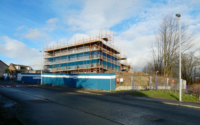
Image: © Lairich Rig Taken: 4 Jan 2016
John Street is in the foreground. On the right is a cycle path / footpath that runs alongside the lade intake here at Dalquhurn: Image / Image The existing houses at the far left are on Martin Gannon Court. The new development will consist of one- and two-bedroom flats and two-bedroom houses. The development site straddles the OS grid line, but its nearer parts are in the OS square from which the picture was taken. For later views, see Image and Image
Images are licensed for reuse under creativecommons.org/licenses/by-sa/2.0
Image Location
Latitude
55.96712
Longitude
-4.581097