Remains of Ropeway, Guisborough Woods
Introduction
The photograph on this page of Remains of Ropeway, Guisborough Woods by Mick Garratt as part of the Geograph project.
The Geograph project started in 2005 with the aim of publishing, organising and preserving representative images for every square kilometre of Great Britain, Ireland and the Isle of Man.

There are currently over 7.5m images from over 14,400 individuals and you can help contribute to the project by visiting https://www.geograph.org.uk
Remains of Ropeway, Guisborough Woods
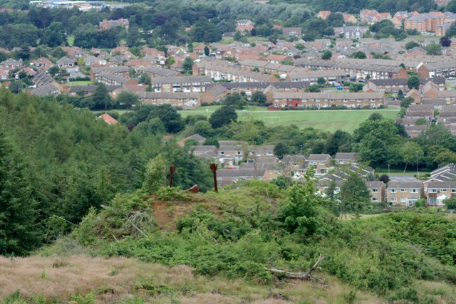
Image: © Mick Garratt Taken: 28 Jun 2007
Until recent felling this spoil tip was completely hidden by trees. Three steel stanchions mark the end of the ropeway for spoil from the New Drift of the Belmont Ironstone Mine which operated from 1907 to 1929. In the distance are the housing estates of Hunter Hill.
Images are licensed for reuse under creativecommons.org/licenses/by-sa/2.0
Image Location


Leaflet Map data © OpenStreetMap
Latitude
54.519401
Longitude
-1.055146