Outskirts of Newark, Notts.
Introduction
The photograph on this page of Outskirts of Newark, Notts. by David Hallam-Jones as part of the Geograph project.
The Geograph project started in 2005 with the aim of publishing, organising and preserving representative images for every square kilometre of Great Britain, Ireland and the Isle of Man.

There are currently over 7.5m images from over 14,400 individuals and you can help contribute to the project by visiting https://www.geograph.org.uk
Outskirts of Newark, Notts.
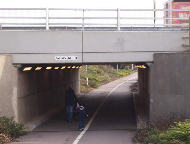
Image: © David Hallam-Jones Taken: 16 Jan 2016
This subway allows pedestrians to travel from the extreme eastern end of Farndon, to proceed beneath the A46 (a.k.a. the Fosse Way and/or the Foss Way), and to join the pavement running alongside the B6166 for the final 20 minute walk into the town centre.
Images are licensed for reuse under creativecommons.org/licenses/by-sa/2.0
Image Location


Leaflet Map data © OpenStreetMap
Latitude
53.064948
Longitude
-0.836258