Bogton Stone Circle (3)
Introduction
The photograph on this page of Bogton Stone Circle (3) by Anne Burgess as part of the Geograph project.
The Geograph project started in 2005 with the aim of publishing, organising and preserving representative images for every square kilometre of Great Britain, Ireland and the Isle of Man.

There are currently over 7.5m images from over 14,400 individuals and you can help contribute to the project by visiting https://www.geograph.org.uk
Bogton Stone Circle (3)
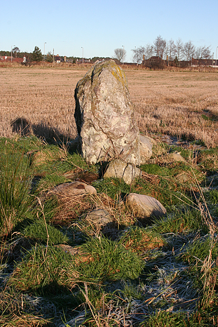
Image: © Anne Burgess Taken: 17 Jan 2016
The standing stone is one of two remaining orthostats of the circle, the rest of which was demolished in 1810. See https://canmore.org.uk/site/16524/bogton for more details. Image]
Images are licensed for reuse under creativecommons.org/licenses/by-sa/2.0
Image Location
Latitude
57.631016
Longitude
-3.216748