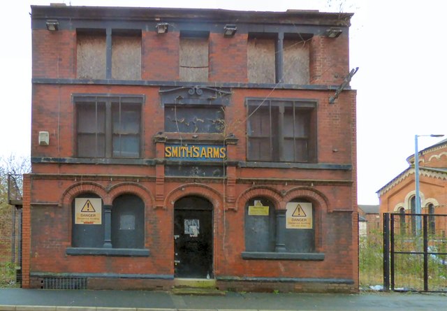
Smith's Arms
Introduction
The photograph on this page of Smith's Arms by Gerald England as part of the Geograph project.
The Geograph project started in 2005 with the aim of publishing, organising and preserving representative images for every square kilometre of Great Britain, Ireland and the Isle of Man.
There are currently over 7.5m images from over 14,400 individuals and you can help contribute to the project by visiting https://www.geograph.org.uk

Image: © Gerald England Taken: 9 Jan 2016
Although earmarked for demolition on more than one plan The Smith's Arms is still standing on Sherratt Street (formerly Spittal Street) in old Ancoats, standing as a defiant relic while old industrial buildings are razed, replaced by the occasional new-build. It was also known as the Blacksmiths Arms and the Hammer in Hand in the 18th century when it was a Taylors Eagle house, then Tetley's and finally a Burtonwood house upon closure at some point in the 1990s. It dates as far back as 1775 when it was built as a three-storey middle class residence, and industrialisation led to its conversion to a public house in 1827. Information from Pubs of Manchester: http://pubs-of-manchester.blogspot.co.uk/2012/03/smiths-arms-sherratt-steet.html An archaeological survey done by Manchester University revealed this to be the oldest surviving public house of its type in Ancoats. A link to the survey can be found on the HistoryMe site: https://historyme.wordpress.com/2011/08/15/the-smith-arms-37-sherratt-st-ancoats-manchester-m4/

