House on the corner of Elm Bank Drive
Introduction
The photograph on this page of House on the corner of Elm Bank Drive by Jonathan Thacker as part of the Geograph project.
The Geograph project started in 2005 with the aim of publishing, organising and preserving representative images for every square kilometre of Great Britain, Ireland and the Isle of Man.

There are currently over 7.5m images from over 14,400 individuals and you can help contribute to the project by visiting https://www.geograph.org.uk
House on the corner of Elm Bank Drive
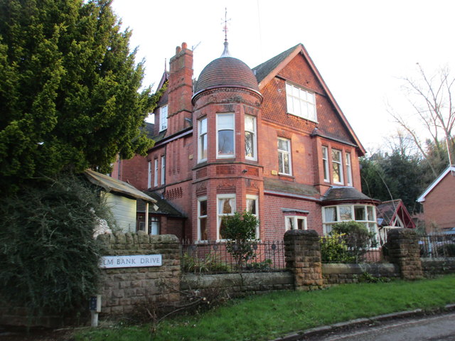
Image: © Jonathan Thacker Taken: 15 Jan 2016
The part of Nottingham north of Mapperley Road was developed from the 1870s onward as a suburb for the relatively affluent. Many of the older houses are hidden behind high walls and trees. This house is relatively visible. It appears to have been built using local brick and is decorated in part with terracotta.
Images are licensed for reuse under creativecommons.org/licenses/by-sa/2.0
Image Location
Latitude
52.96897
Longitude
-1.147514