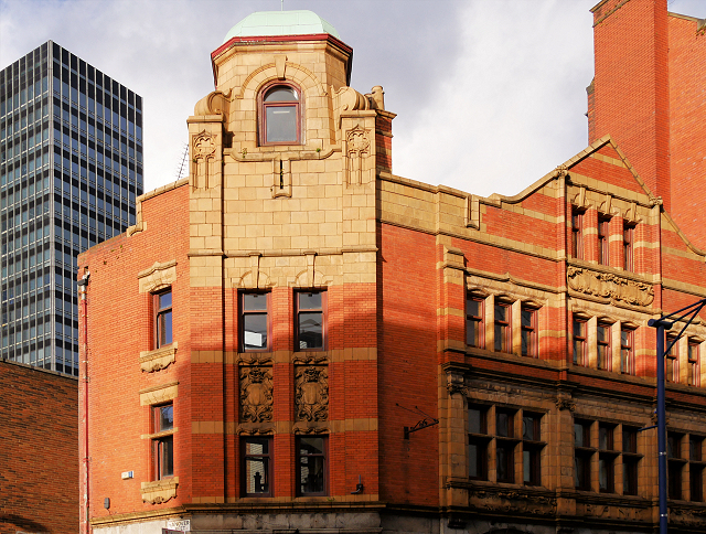
77 Shudehill
Introduction
The photograph on this page of 77 Shudehill by David Dixon as part of the Geograph project.
The Geograph project started in 2005 with the aim of publishing, organising and preserving representative images for every square kilometre of Great Britain, Ireland and the Isle of Man.
There are currently over 7.5m images from over 14,400 individuals and you can help contribute to the project by visiting https://www.geograph.org.uk

Image: © David Dixon Taken: 15 Jan 2016
At street-level, this old building at 77 Shudehill houses “The Pasta Factory”, an Italian restaurant and takeaway. The building itself is probably from the early 20th century. I couldn’t see any datestone on it but it adjoins, and is similar in style to, “The Stovell’s Buildings”, a former umbrella and walking stick factory which was built in stages from 1900 to 1915. It may have been built as a bank, lettering above the ground floor windows (Image]) indicates that it has certainly housed a bank at some time during its history.

