Sandhurst Avenue, Mansfield, Notts.
Introduction
The photograph on this page of Sandhurst Avenue, Mansfield, Notts. by David Hallam-Jones as part of the Geograph project.
The Geograph project started in 2005 with the aim of publishing, organising and preserving representative images for every square kilometre of Great Britain, Ireland and the Isle of Man.

There are currently over 7.5m images from over 14,400 individuals and you can help contribute to the project by visiting https://www.geograph.org.uk
Sandhurst Avenue, Mansfield, Notts.
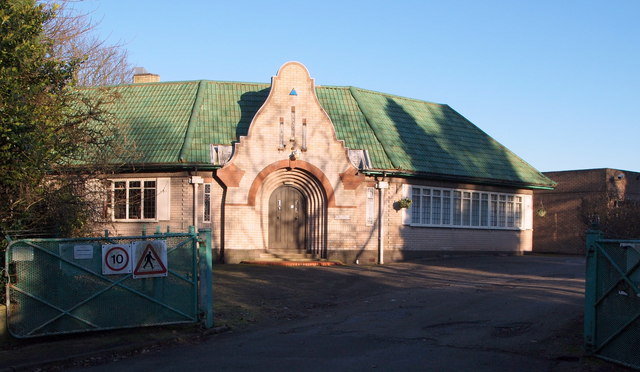
Image: © David Hallam-Jones Taken: 15 Jan 2016
The entrance to the Mansfield Sand Company's premises (formerly Gregory's Quarry ?) at the Berry Hill Lane end of Sandhurst Avenue. This is a view of the combined gatekeeper's lodge and office. Sand from this quarry was reputed to be the finest in the UK and was used extensively in both local foundries and those further afield.
Images are licensed for reuse under creativecommons.org/licenses/by-sa/2.0
Image Location
Latitude
53.130101
Longitude
-1.192156