Mill Street, Nayland
Introduction
The photograph on this page of Mill Street, Nayland by Robin Webster as part of the Geograph project.
The Geograph project started in 2005 with the aim of publishing, organising and preserving representative images for every square kilometre of Great Britain, Ireland and the Isle of Man.

There are currently over 7.5m images from over 14,400 individuals and you can help contribute to the project by visiting https://www.geograph.org.uk
Mill Street, Nayland
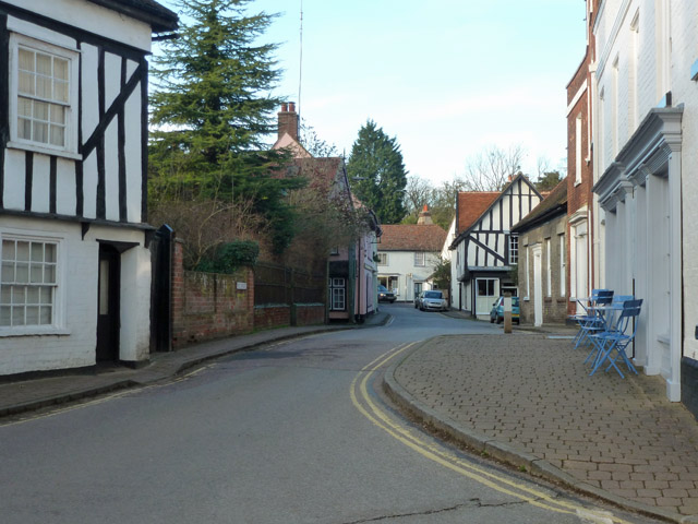
Image: © Robin Webster Taken: 13 Jan 2016
This short street once had two water mills on it. One is near right, with the parapet of the mill stream bridge being the brick wall just past the near house on the left. The mill stream survives. The other was nearly at the far end of the street, no obvious trace of this survives. The mill stream is reported to be culverted; there is no obvious above ground trace of this either.
Images are licensed for reuse under creativecommons.org/licenses/by-sa/2.0
Image Location


Leaflet Map data © OpenStreetMap
Latitude
51.972519
Longitude
0.873779