Roman road, Buckholt Lane, Buckholt
Introduction
The photograph on this page of Roman road, Buckholt Lane, Buckholt by Andy Gryce as part of the Geograph project.
The Geograph project started in 2005 with the aim of publishing, organising and preserving representative images for every square kilometre of Great Britain, Ireland and the Isle of Man.

There are currently over 7.5m images from over 14,400 individuals and you can help contribute to the project by visiting https://www.geograph.org.uk
Roman road, Buckholt Lane, Buckholt
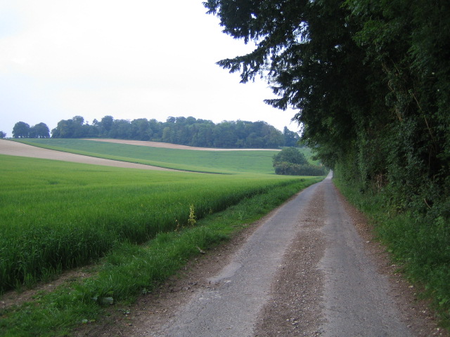
Image: © Andy Gryce Taken: 10 Jun 2007
This road is Buckholt Lane, looking east, which is on the Monarch's Way and Clarendon Way long distance footpaths, as well as on the line of a Roman road. This road went from Old Sarum (then Sorviodunum), the original site of Salisbury, in the west to Winchester (then Venta Belgarum) in the east, a distance of 21.5 miles. The road runs up to Buckholt Farm, which is to the right of the woods in the distance, and then turns south.
Images are licensed for reuse under creativecommons.org/licenses/by-sa/2.0
Image Location


Leaflet Map data © OpenStreetMap
Latitude
51.08901
Longitude
-1.61187