Huddersfield Road, Fixby
Introduction
The photograph on this page of Huddersfield Road, Fixby by Humphrey Bolton as part of the Geograph project.
The Geograph project started in 2005 with the aim of publishing, organising and preserving representative images for every square kilometre of Great Britain, Ireland and the Isle of Man.

There are currently over 7.5m images from over 14,400 individuals and you can help contribute to the project by visiting https://www.geograph.org.uk
Huddersfield Road, Fixby
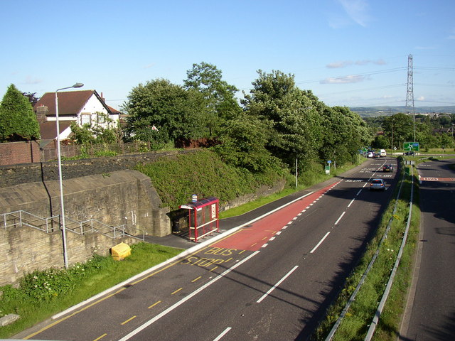
Image: © Humphrey Bolton Taken: 27 Jun 2007
This road has been in cutting since it was built in the early 19C. A bit of old stone walling can be seen beyond the bus shelter, showing that when it was widened the land was taken from the right-hand (western) side.
Images are licensed for reuse under creativecommons.org/licenses/by-sa/2.0
Image Location


Leaflet Map data © OpenStreetMap
Latitude
53.670953
Longitude
-1.828925