East Stoke, Notts.
Introduction
The photograph on this page of East Stoke, Notts. by David Hallam-Jones as part of the Geograph project.
The Geograph project started in 2005 with the aim of publishing, organising and preserving representative images for every square kilometre of Great Britain, Ireland and the Isle of Man.

There are currently over 7.5m images from over 14,400 individuals and you can help contribute to the project by visiting https://www.geograph.org.uk
East Stoke, Notts.
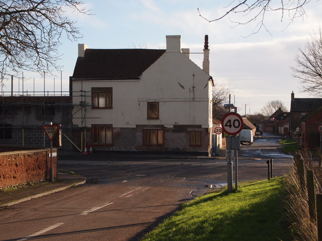
Image: © David Hallam-Jones Taken: 10 Jan 2016
Most of this small village lies behind the photographer on School Lane and Church Lane (each a continuation of the other). This view - from School Lane - however, indicates how the village is bisected by the former A46 road (now known as either the Foss Way or the Fosse Way). The new dual carriageway version of the A46 runs parallel with the Foss/Fosse Way 2-3 mins along the road seen ahead, i.e. Moor Lane (although no access is possible to the new road from Moor Lane). Nottingham is reached by taking a right-hand turning at this junction and Newark via a left-hand turn. The building on the corner, that is currently being redeveloped into residential units, was formerly The Pauncesfot Arms public house. More recently it saw service as a none-to-successful Indian restaurant.
Images are licensed for reuse under creativecommons.org/licenses/by-sa/2.0
Image Location
Latitude
53.038915
Longitude
-0.877527