River Chelmer in flood, 1990
Introduction
The photograph on this page of River Chelmer in flood, 1990 by Robin Webster as part of the Geograph project.
The Geograph project started in 2005 with the aim of publishing, organising and preserving representative images for every square kilometre of Great Britain, Ireland and the Isle of Man.

There are currently over 7.5m images from over 14,400 individuals and you can help contribute to the project by visiting https://www.geograph.org.uk
River Chelmer in flood, 1990
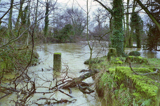
Image: © Robin Webster Taken: Unknown
Looking downstream from the site of Little Waltham Mill, last shown on maps in 1896. The main river comes in from the right, and these days the mill race normally passes only local drainage or nothing, but here is flooded. Even so, there seems to be little flow in it.
Images are licensed for reuse under creativecommons.org/licenses/by-sa/2.0
Image Location
Latitude
51.784663
Longitude
0.477994