Grantham, Lincs.
Introduction
The photograph on this page of Grantham, Lincs. by David Hallam-Jones as part of the Geograph project.
The Geograph project started in 2005 with the aim of publishing, organising and preserving representative images for every square kilometre of Great Britain, Ireland and the Isle of Man.

There are currently over 7.5m images from over 14,400 individuals and you can help contribute to the project by visiting https://www.geograph.org.uk
Grantham, Lincs.
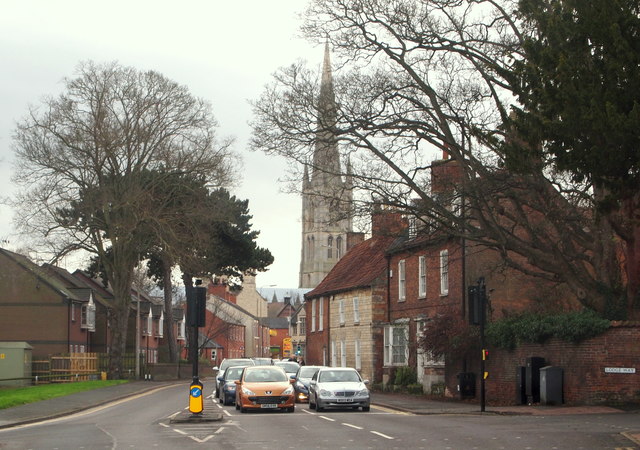
Image: © David Hallam-Jones Taken: 26 Dec 2015
Continuing ahead, the A607 (Manthorpe Road), is seen here at the Lodge Way crossroads. The tower and the 282 ft high spire of St Wulfam's Church can, understandably, also be seen from afar.
Images are licensed for reuse under creativecommons.org/licenses/by-sa/2.0
Image Location
Latitude
52.918581
Longitude
-0.640138