214 Lambeth Road
Introduction
The photograph on this page of 214 Lambeth Road by Stephen Richards as part of the Geograph project.
The Geograph project started in 2005 with the aim of publishing, organising and preserving representative images for every square kilometre of Great Britain, Ireland and the Isle of Man.

There are currently over 7.5m images from over 14,400 individuals and you can help contribute to the project by visiting https://www.geograph.org.uk
214 Lambeth Road
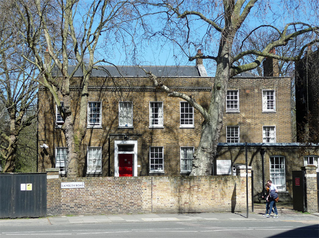
Image: © Stephen Richards Taken: 20 Apr 2013
A five-bay house set back in its grounds, dated 1828-29 when it was built as a rectory. It was added to a house of 1778, partly visible on the right. Grade II listed. At the time student accommodation but it appears since to have reverted to a private house.
Images are licensed for reuse under creativecommons.org/licenses/by-sa/2.0
Image Location
Latitude
51.495359
Longitude
-0.117182