Laggan House
Introduction
The photograph on this page of Laggan House by Ian Capper as part of the Geograph project.
The Geograph project started in 2005 with the aim of publishing, organising and preserving representative images for every square kilometre of Great Britain, Ireland and the Isle of Man.

There are currently over 7.5m images from over 14,400 individuals and you can help contribute to the project by visiting https://www.geograph.org.uk
Laggan House
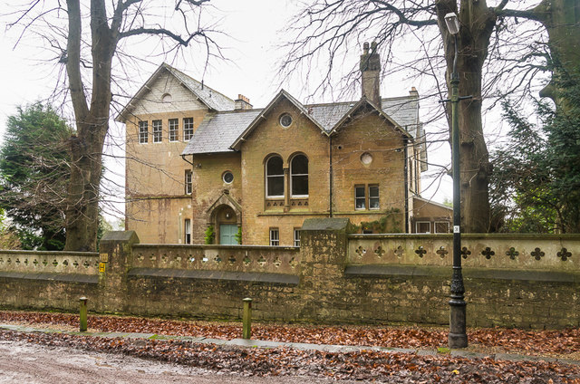
Image: © Ian Capper Taken: 11 Dec 2015
Large Victorian house in College Road now divided into seven flats. It was originally called The Limes, before its name was changed to Laggan (appearing as such in the 1933 6 inch map), before the addition of the word House gave it its current name. Among its uses have been a boarding house for the Royal School for Daughters of Officers of the Army in nearby Lansdown Road (now part of Royal High School, Bath). In the early part of the Second World War, the school was evacuated to Longleat, and was requisitioned by the Admiralty's Hydrographic Department, and Laggan was used to house HM Nautical Almanac Office as well as the Assistant Hydrographer, the Tides Department and the Superintendent of Sailing Directions and his staff. These were housed here from September 1939 until November 1941 when they moved to Block E of new office developments at Ensleigh, further up Lansdown Road (see Image). For article on the HMNAO, including its time at Laggan, see http://www.royalobservatorygreenwich.org/articles.php?article=913.
Images are licensed for reuse under creativecommons.org/licenses/by-sa/2.0
Image Location
Latitude
51.395742
Longitude
-2.370929