Oxhill Farm
Introduction
The photograph on this page of Oxhill Farm by Robert Graham as part of the Geograph project.
The Geograph project started in 2005 with the aim of publishing, organising and preserving representative images for every square kilometre of Great Britain, Ireland and the Isle of Man.

There are currently over 7.5m images from over 14,400 individuals and you can help contribute to the project by visiting https://www.geograph.org.uk
Oxhill Farm
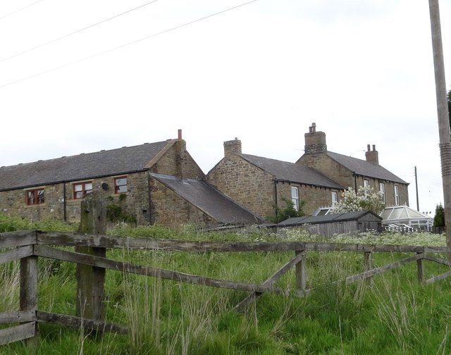
Image: © Robert Graham Taken: 30 May 2014
Located at the western end of Oxhill, a suburb of Stanley. Not now a working farm. The building on the right is the former farmhouse probably early-mid C19 in origin.
Images are licensed for reuse under creativecommons.org/licenses/by-sa/2.0
Image Location
Latitude
54.864242
Longitude
-1.712835