Trapped flood water, Carlisle Rugby Club
Introduction
The photograph on this page of Trapped flood water, Carlisle Rugby Club by Rose and Trev Clough as part of the Geograph project.
The Geograph project started in 2005 with the aim of publishing, organising and preserving representative images for every square kilometre of Great Britain, Ireland and the Isle of Man.

There are currently over 7.5m images from over 14,400 individuals and you can help contribute to the project by visiting https://www.geograph.org.uk
Trapped flood water, Carlisle Rugby Club
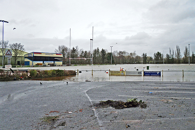
Image: © Rose and Trev Clough Taken: 9 Dec 2015
The ground is off Warwick Road, in an area of Carlisle hit by serious flooding on 6 December 2015. At the height of the flood, the water level was just below the goal crossbar (as seen in photos on the Rugby Club website http://www.pitchero.com/clubs/carlislerugby ). The rivers Petteril and Eden overtopped nearby flood banks, which then prevented the water from flowing back. A few days later the site was drained by putting relief channels in the defences, and deployment of pumps.
Images are licensed for reuse under creativecommons.org/licenses/by-sa/2.0
Image Location
Latitude
54.895355
Longitude
-2.91724