Flooding of the A6 in Walton-le-Dale
Introduction
The photograph on this page of Flooding of the A6 in Walton-le-Dale by Adam C Snape as part of the Geograph project.
The Geograph project started in 2005 with the aim of publishing, organising and preserving representative images for every square kilometre of Great Britain, Ireland and the Isle of Man.

There are currently over 7.5m images from over 14,400 individuals and you can help contribute to the project by visiting https://www.geograph.org.uk
Flooding of the A6 in Walton-le-Dale
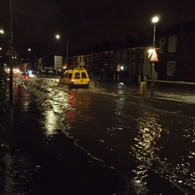
Image: © Adam C Snape Taken: 26 Dec 2015
Taken at 22.35 on Boxing day night, 2015. Houses alongside the A6, Victoria Road had been flooded as the River Ribble at Walton-le-Dale reached a record level https://web.archive.org/web/20151227215712/http://www.blogpreston.co.uk/2015/12/watch-river-ribble-pressure-on-walton-le-dale-flood-wall-as-residents-evacuate-homes/ The road itself remained just about passable but the depth of water made it more like negotiating a rural ford than travelling along one of the main roads into a city.
Images are licensed for reuse under creativecommons.org/licenses/by-sa/2.0
Image Location
Latitude
53.750864
Longitude
-2.676772