River Derwent in flood at Malton 27th Dec 2015 (11)
Introduction
The photograph on this page of River Derwent in flood at Malton 27th Dec 2015 (11) by Martin Dawes as part of the Geograph project.
The Geograph project started in 2005 with the aim of publishing, organising and preserving representative images for every square kilometre of Great Britain, Ireland and the Isle of Man.

There are currently over 7.5m images from over 14,400 individuals and you can help contribute to the project by visiting https://www.geograph.org.uk
River Derwent in flood at Malton 27th Dec 2015 (11)
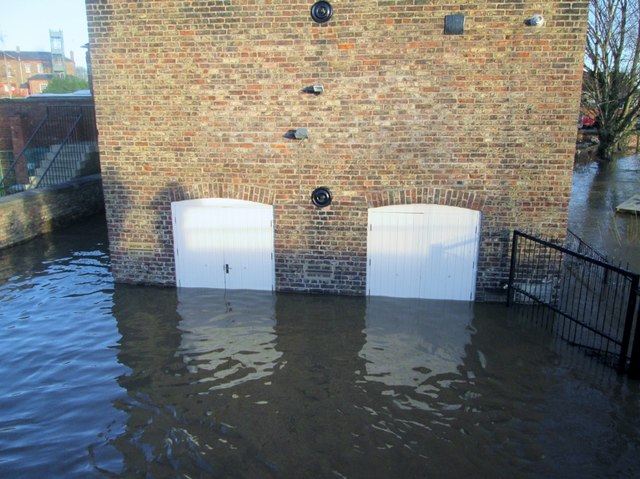
Image: © Martin Dawes Taken: 27 Dec 2015
The flood defence wall is to the left of the warehouse!! To the left of the white doors is a Flood Level mark for November 2000, in between the doors is the mark for March 1999, two other marks are to the right,older and obscured by the fencing.
Images are licensed for reuse under creativecommons.org/licenses/by-sa/2.0
Image Location
Latitude
54.13318
Longitude
-0.790915