Pinfold off Intake Road, Slaithwaite
Introduction
The photograph on this page of Pinfold off Intake Road, Slaithwaite by Humphrey Bolton as part of the Geograph project.
The Geograph project started in 2005 with the aim of publishing, organising and preserving representative images for every square kilometre of Great Britain, Ireland and the Isle of Man.

There are currently over 7.5m images from over 14,400 individuals and you can help contribute to the project by visiting https://www.geograph.org.uk
Pinfold off Intake Road, Slaithwaite
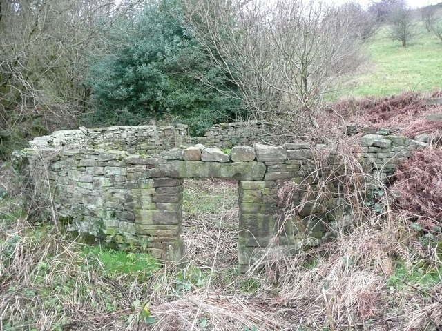
Image: © Humphrey Bolton Taken: 27 Dec 2015
This is between Wilberlee and Ainley Place alongside Barrett Clough, which was perhaps a land ownership boundary; it was not a local government boundary. The pinfold is listed, Grade II, and the listing details state that it was built in the late 18C or early 19C; it is shown on the 1850 six-inch map. It is in very good condition.
Images are licensed for reuse under creativecommons.org/licenses/by-sa/2.0
Image Location
Latitude
53.630319
Longitude
-1.902882