New Low Barcus Close farmhouse
Introduction
The photograph on this page of New Low Barcus Close farmhouse by Robert Graham as part of the Geograph project.
The Geograph project started in 2005 with the aim of publishing, organising and preserving representative images for every square kilometre of Great Britain, Ireland and the Isle of Man.

There are currently over 7.5m images from over 14,400 individuals and you can help contribute to the project by visiting https://www.geograph.org.uk
New Low Barcus Close farmhouse
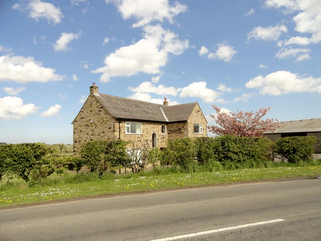
Image: © Robert Graham Taken: 14 May 2014
This farm stands on Barcusclose Lane, which runs east from Crookgate to Tanfield village. It's not the farm that the lane is named after; that stood a short way west along the lane and was demolished in the 1990's. The original, C19, Low Barcus was destroyed by fire in 1973 and this farm was built to replace it shortly afterwards. It was built in stone in a traditional manner and looks older than it actually is.
Images are licensed for reuse under creativecommons.org/licenses/by-sa/2.0
Image Location
Latitude
54.8991
Longitude
-1.708845