East Brighton Park
Introduction
The photograph on this page of East Brighton Park by Simon Carey as part of the Geograph project.
The Geograph project started in 2005 with the aim of publishing, organising and preserving representative images for every square kilometre of Great Britain, Ireland and the Isle of Man.

There are currently over 7.5m images from over 14,400 individuals and you can help contribute to the project by visiting https://www.geograph.org.uk
East Brighton Park
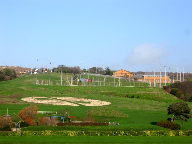
Image: © Simon Carey Taken: 23 Dec 2015
Viewed from the access road to East Brighton Golf Course with the buildings of City College on the right beyond the astroturf pitches. The land was acquired by Brighton council in 1913 from Ovingdean parish with the land once a field called Black Rock House Laine according to its 1839 tithe map and landscaped into a public park in 1925.
Images are licensed for reuse under creativecommons.org/licenses/by-sa/2.0
Image Location
Latitude
50.819634
Longitude
-0.10119