Kilgetty Belvedere
Introduction
The photograph on this page of Kilgetty Belvedere by Humphrey Bolton as part of the Geograph project.
The Geograph project started in 2005 with the aim of publishing, organising and preserving representative images for every square kilometre of Great Britain, Ireland and the Isle of Man.

There are currently over 7.5m images from over 14,400 individuals and you can help contribute to the project by visiting https://www.geograph.org.uk
Kilgetty Belvedere
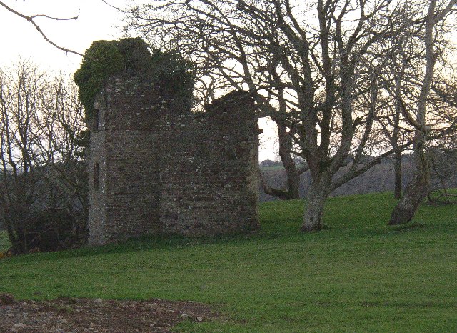
Image: © Humphrey Bolton Taken: 22 Mar 2005
This was in the grounds of Kilgetty House, now demolished. The remains of its gardens, made c.1725-1743, are in fields near Kilgetty farm. The Belvedere is at SN137084, very close to the new cutting for the A477 road.
Images are licensed for reuse under creativecommons.org/licenses/by-sa/2.0
Image Location


Leaflet Map data © OpenStreetMap
Latitude
51.74408
Longitude
-4.702835