Old boundary wall
Introduction
The photograph on this page of Old boundary wall by Robert Graham as part of the Geograph project.
The Geograph project started in 2005 with the aim of publishing, organising and preserving representative images for every square kilometre of Great Britain, Ireland and the Isle of Man.

There are currently over 7.5m images from over 14,400 individuals and you can help contribute to the project by visiting https://www.geograph.org.uk
Old boundary wall
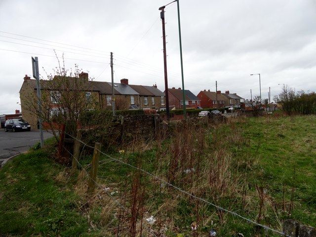
Image: © Robert Graham Taken: 9 Apr 2014
This old wall is on North Road, Dipton, next to the junction with Bushblades Lane. It probably formed the boundary wall of Bushblades Township, at the edge of Lanchester Common. After the 1773 Enclosures Act, North road was set out and the wall would have formed part of the boundary of this road. The street across the road is Poplar Grove.
Images are licensed for reuse under creativecommons.org/licenses/by-sa/2.0
Image Location
Latitude
54.879329
Longitude
-1.748887