Gunbarrel Alley, Nailsworth
Introduction
The photograph on this page of Gunbarrel Alley, Nailsworth by Jaggery as part of the Geograph project.
The Geograph project started in 2005 with the aim of publishing, organising and preserving representative images for every square kilometre of Great Britain, Ireland and the Isle of Man.

There are currently over 7.5m images from over 14,400 individuals and you can help contribute to the project by visiting https://www.geograph.org.uk
Gunbarrel Alley, Nailsworth
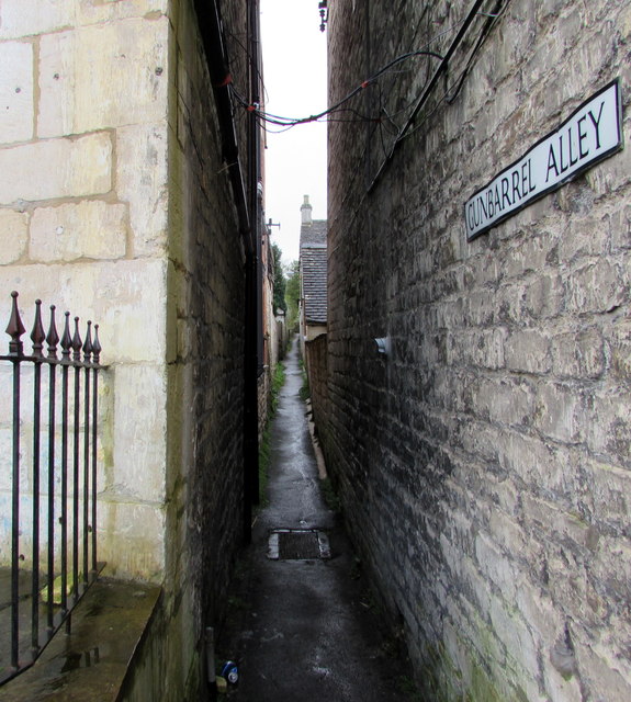
Image: © Jaggery Taken: 20 Dec 2015
The narrow alley heads southeastwards away from Church Street. The name sign is on the side wall of Walkers fish & chips shop. http://www.geograph.org.uk/photo/4770894 The origin of this colourful name is a mystery. My first thought was perhaps a comparison with the narrowness and straightness of a gun barrel, but that's no doubt fanciful. Local websites, helpful with the history of much of Nailsworth, give no information about this name, which appears to be the only example of an alley (or street, road, etc) named Gunbarrel in the UK.
Images are licensed for reuse under creativecommons.org/licenses/by-sa/2.0
Image Location
Latitude
51.694317
Longitude
-2.218126